Drone Crop Mapping, Variable Rate Files & Precision Ag Services
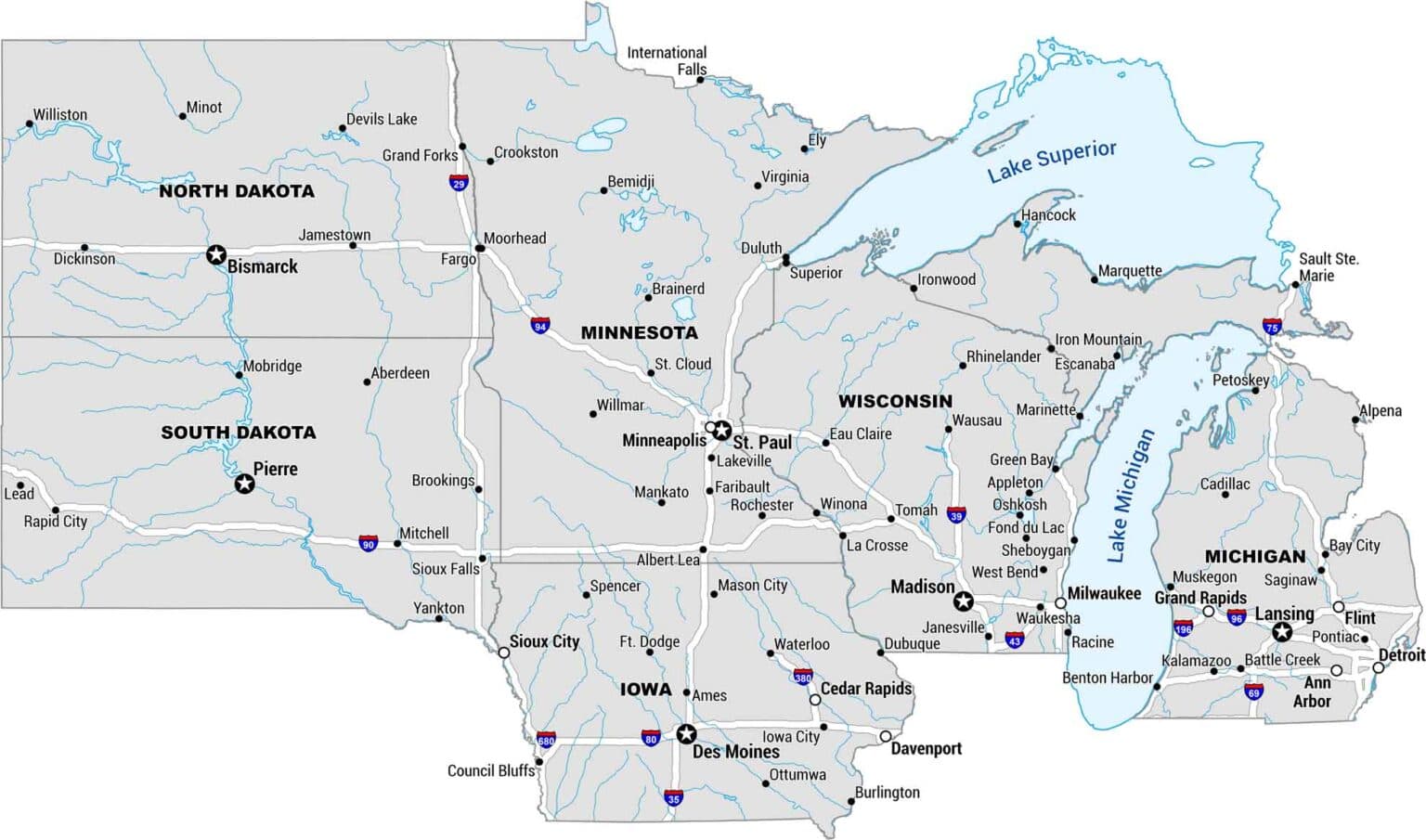
We serve corn, soybean, and potato growers throughout Minnesota, North Dakota, and South Dakota with field zone mapping, NDVI drone crop health monitoring, soil sampling, and variable rate prescription files for planters, fertilizers, and fungicides. Every service is built around your fields. We combine multispectral drone imagery with on-the-ground agronomy expertise to help you place every input exactly where it earns its keep.
Field Zone Mapping & Soil Sampling
Detailed field zone maps and precision soil sampling for corn, soybean, and potato acres across Minnesota, North Dakota, and South Dakota. We build as many management zones as your agronomic goals demand, then sample by zone so your fertilizer prescription is based on real nutrient data — not averages.
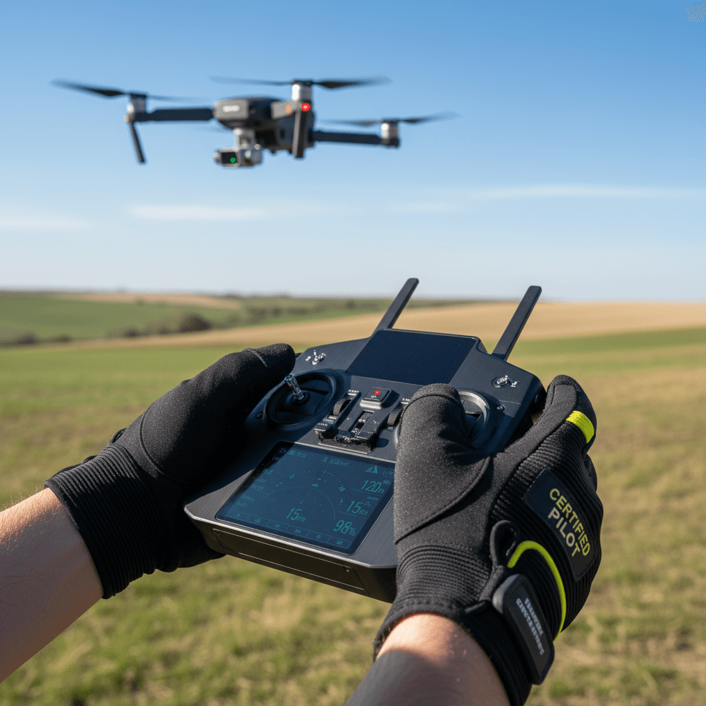
Drone Crop Health Mapping (NDVI & NDRE)
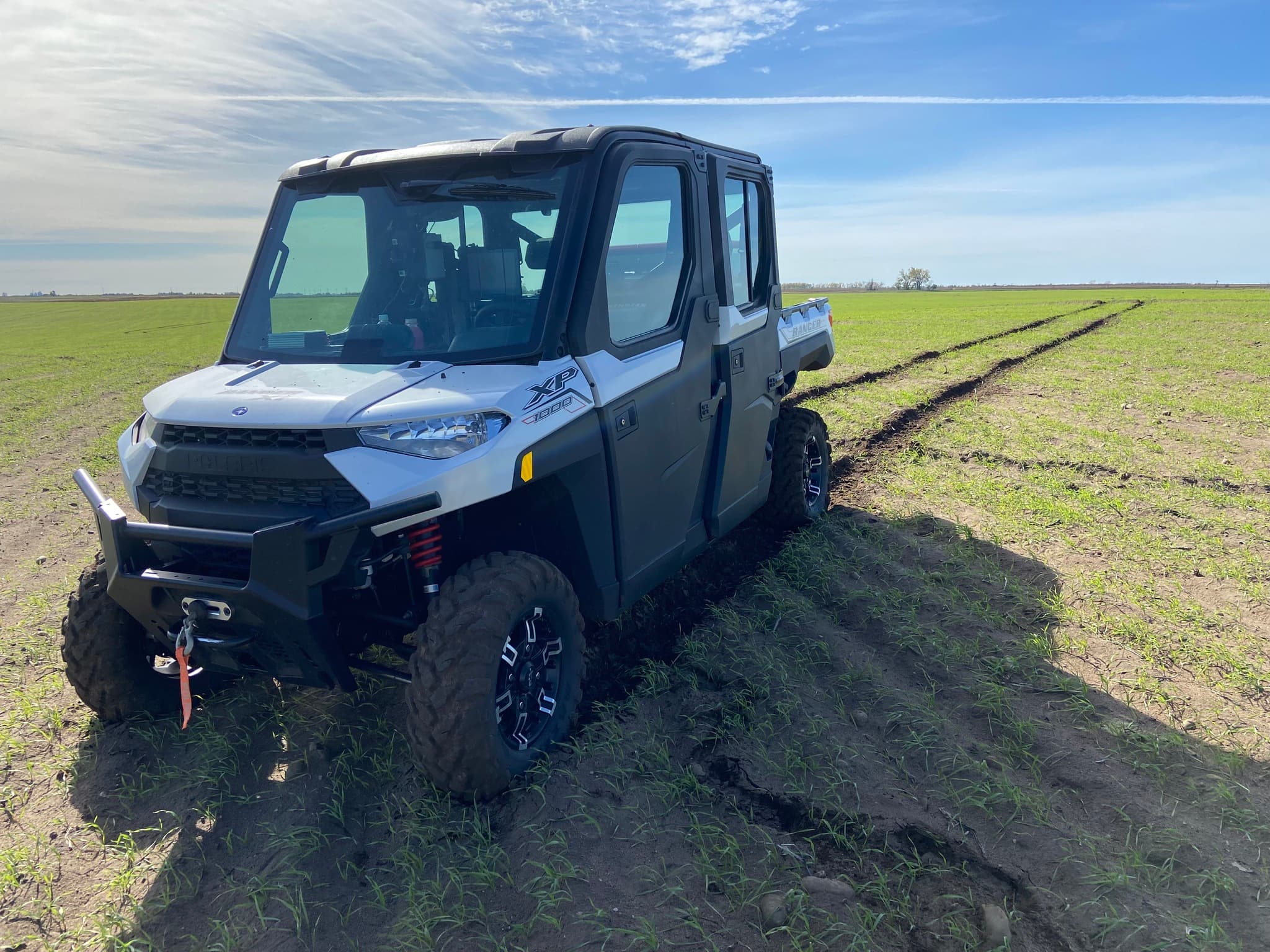
Multispectral drone imagery using NDVI and NDRE vegetation indices to map plant health, spot stress, assess stand counts, and detect issues before they cost you yield. We fly corn, soybeans, and potatoes throughout the upper Midwest and turn aerial data into actionable crop health scouting reports.
Variable Rate Prescription Files
Custom variable rate prescription files for planters, fertilizers, and fungicides — built from your field's zone maps, soil samples, and drone imagery. We deliver ready-to-load files that put the right rate in the right place, reducing input waste and maximizing return on every acre of corn, soybeans, and potatoes.
Crop Health Scouting & Agronomy
In-season crop health scouting paired with agronomic analysis tailored to your operation. We combine drone imagery, soil data, and boots-on-the-ground field knowledge to give corn, soybean, and potato growers clear, timely recommendations on fertility, fungicide timing, and input placement.
Serving the Upper Midwest: MN, ND & SD
From the Red River Valley to central Minnesota's corn and soybean country, we know upper Midwest soils, weather, and crop pressures. That regional expertise paired with precision ag technology helps growers across Minnesota, North Dakota, and South Dakota farm smarter and more profitably.
Precision Agriculture. Trusted Across the Upper Midwest.
We know upper Midwest soils, weather, and crop pressures — and we pair that regional expertise with precision ag technology to help you farm smarter.
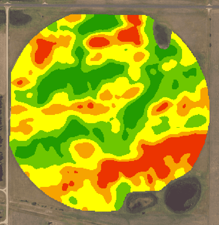
Field Zone Mapping: What It Is and Why It Matters
Every field tells a different story. Soil types shift, drainage varies, and yield potential changes from one end of a field to the other — especially across the diverse landscapes of Minnesota, North Dakota, and South Dakota. Field zone mapping identifies those differences so your equipment can respond with precision. We build management zones using soil surveys, yield data, topography, and multispectral drone imagery, then create variable rate prescription files that put the right inputs in the right places, at the right rates. The result is less fertilizer waste on low-productivity zones, higher plant populations where the ground can support them, and a clearer picture of what every acre is actually capable of.
How Drone NDVI Crop Health Monitoring Works
NDVI and NDRE are multispectral imaging techniques that measure plant health by analyzing how crops reflect different wavelengths of light. Our drone-mounted sensors capture high-resolution multispectral imagery over corn, soybean, and potato fields across Minnesota, North Dakota, and South Dakota. Healthy, vigorously growing plants reflect near-infrared light differently than stressed or thin stands — and those differences show up as color-coded maps you can act on. We use NDVI for early to mid-season vigor assessment and NDRE for later-season crop health monitoring when canopy density can saturate standard NDVI readings. The result is a crop health scouting report that shows you exactly where to investigate, sample, or adjust inputs — before a problem shows up on the yield monitor.
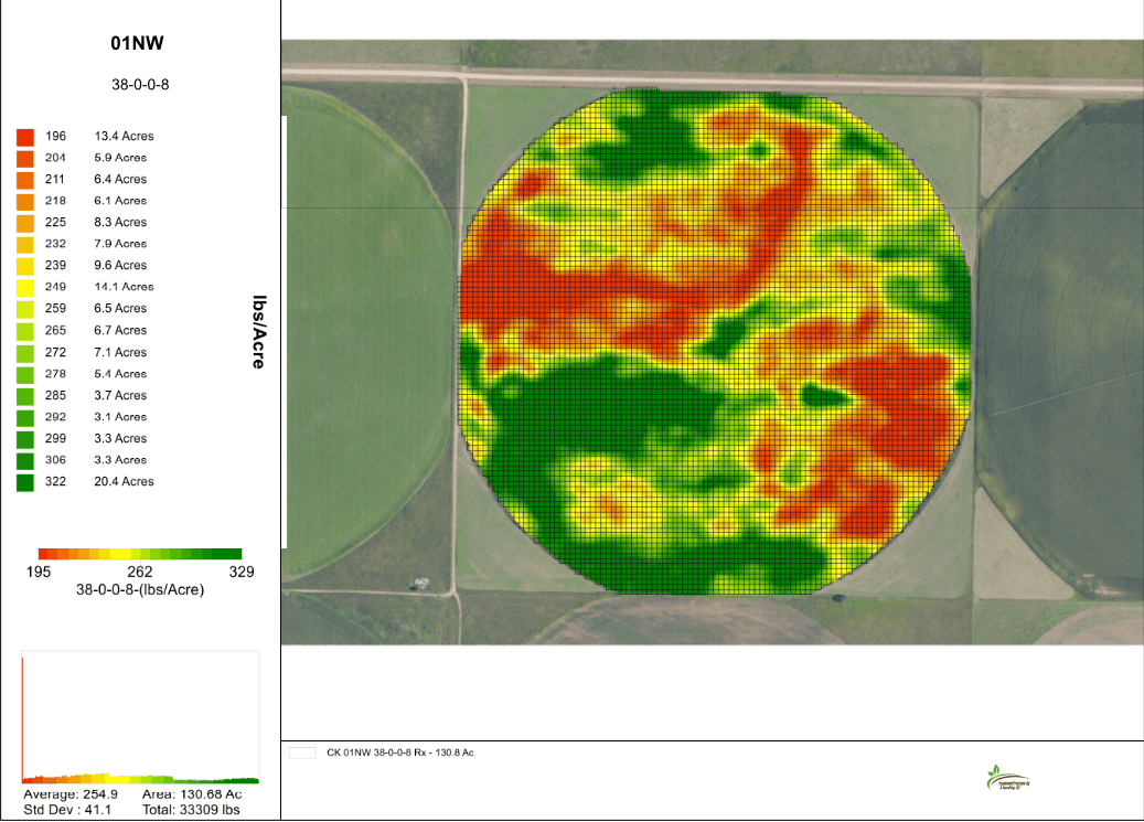
Variable Rate Prescription Files: Smarter Input Management for Corn, Soybeans & Potatoes
Variable rate prescription files let you break free from flat-rate application and manage inputs precisely where they are needed. We build custom prescriptions for planters, fertilizers, and fungicides using the data we have gathered from your fields — zone maps, soil sample results, drone NDVI imagery, and yield history. For corn growers, that means matching plant populations and nitrogen rates to yield potential zone by zone. For soybeans, it is about targeted fertility and fungicide timing based on crop health maps. For potato producers, precise input management across variable soils can make the difference between a contract-grade crop and a discount. Every prescription file is delivered ready to load into your display — compatible with major precision ag platforms — so you can move from data to action without extra steps.
Elevate Your Field Performance With Precision Agriculture
Schedule a consultation with Vaadeland Precision Ag and Consulting, LLC to discuss how precision agriculture can improve your operation.